
Weather
Four days after hitting 90 degrees, La Crosse region could get 7-plus inches of snow
On April 12, La Crosse set a record high temp at 90, breaking the record set in 1931 by nine degrees. Four days later, the area could get 7 or more inches of snow.

The National Weather Service – La Crosse (NWS) says the snow could come in be even “higher amounts,” locally.
Wind gusts could hit 35-45 miles per hour, causing drifts and the storm could shift, resulting in a “subsequent shift in the heavy snow band,” NWS said.
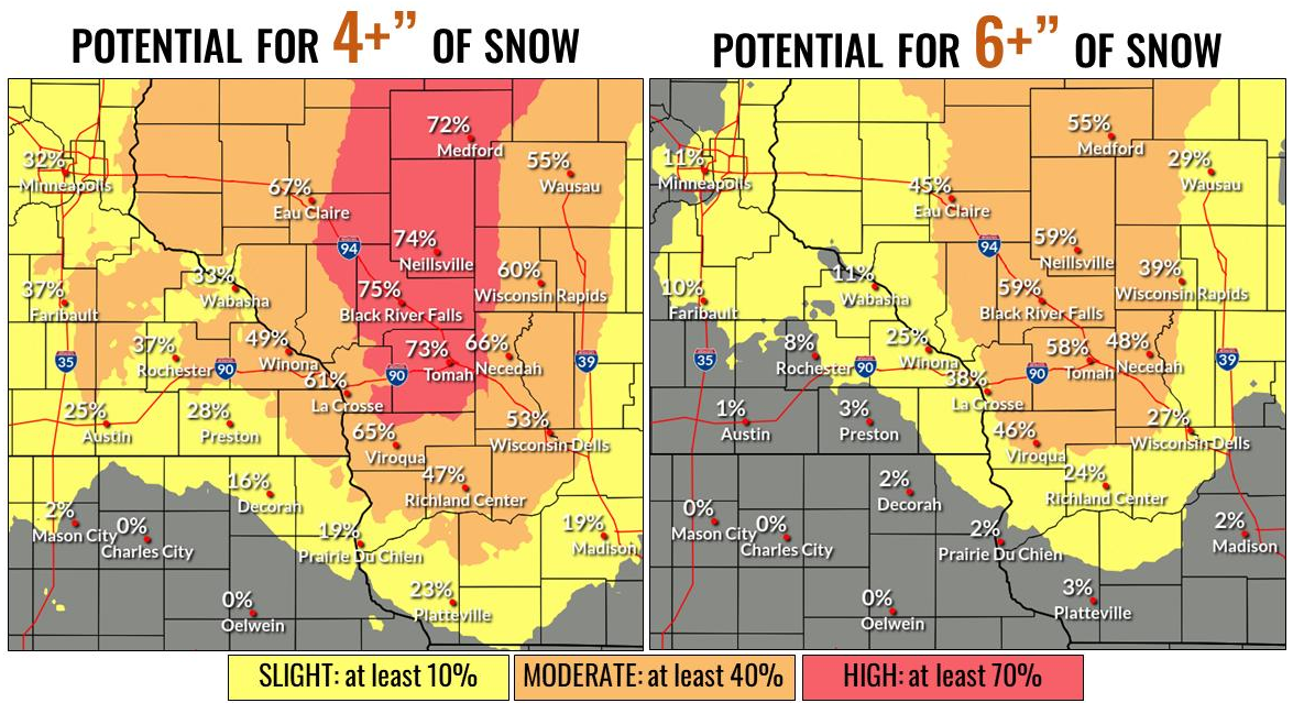
The National Weather Service notes that from Sunday evening into Monday morning the area could see anywhere from light to heavy snow, mainly across southeast Minnesota and into western Wisconsin.
For the Mississippi River towns, the chance for 6-plus inches of snow is 10 percent, though La Crosse is right on the border between 10 and that number jumping to 40 percent — which is where areas east are categorized.
Mississippi River towns’ chances for 4-plus inches of snow is 40 percent, while that increases to a 70 percent chance in Tomah and straight north from there.